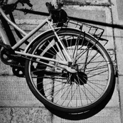
It has been some time since I did a pictorial on Taipei. It is a lot easier to do a pictorial than an editorial, and not forgetting the massive work I have lined up after coming back from Turkey and Henan Province. In the mean time…


Brian on the internet
It has been some time since I did a pictorial on Taipei. It is a lot easier to do a pictorial than an editorial, and not forgetting the massive work I have lined up after coming back from Turkey and Henan Province. In the mean time…

Woke up today to a great day, and for Shanghai this means cloudless day (there’s almost always some kind of haze over the city) and at least being able to see a shadow. My usual tennis session has been cancelled, and how can I waste such a nice day. First thing that sprung to mind is to attempt what I wanted to do since I arrived here, to reach the Yangzi River, or at least close, by cycling.

Google maps showed that the best and safest way is to get over to Pudong and then cycling on Yang Gao Rd as there is a bicycle lane on each side of the road. There are normally some slow bicycles, but as motorcycles also use the same lane, there’s always a way to bypass the slow pokes especially when you cruise at 25kmph to 30kmph.
Continue reading “Cycling to Port of Shanghai at Waigaoqiao (58km)”

The eroded landscapes around Guilin is one of those sceneries that one would think about when China comes to mind. The picture of many little karst hills in the countryside, and a calm river in the foreground with a lone fisherman. This is one of those areas I wanted to go before leaving China, and as famous as it is (meaning many tourists) I guess this is one of those places that has to be seen to be believed. So then it is, I have managed to organize a trip to Guanxi province just after the Sichuan trip on the way back to Shanghai just to see it with my own eyes. Will be flying into Guilin directly from Chengdu.
20 November 2008: Landed in Guilin at 9 pm after an hour and a half from Chengdu. Small airport, obviously so compared to Chengdu and probably not a good comparison at all. Slept during the landing and since it was late at night, it was probably impossible to see anything. Temperature is a nice 13C at night. Balmy compared to Chengdu in the single digits.

My luggage is one of the first to appear, good considering I was the last to check in! In 1 minute I was out of Guilin Liangjiang airport (yup, the official name) and into a Golden Dragon brand bus bound downtown. I’m not a guide book so I have no idea where this bus ends but it does go to Guilin Train Station and its where I am going. Dumped my backpack into the luggage hold and its time to wait 30 minutes. The cost of the bus to the train station from airport is 20 RMB. According to what people tell me, as long there is a flight arriving, there will be an airport bus.
Within 30 minutes the bus dropped me at Shanghai Road with a finger pointing to the direction of the train station, quite obvious it requires a bit of a walk. Looking at the GPS maps on my E71, I managed to find a signboard leading to the Flowers Youth Hostel in Guilin. I will have to walk through little alleys and small restaurants selling dodgy food (i’m sure it tastes good though) and mini travel agents. Hostel is on the second floor of a maze of buildings. No fanfare, I’d arrive, get the room, get a shower and do a little blogging and sleep to prepare for the next day to Yangshuo.
After a few months off my bicycle, and because of the long long boring weekend in Shanghai, I decided to go out cycling in my playground, Pudong in Shanghai. Definitely had to dust off significant amount of cobwebs on my modified Felt F1X converted into a pseudo road-bike, and a little bit of voodoo with the weather.
Weather looked cloudy today Monday, but the rain looked sporadic from my apartment’s 31st floor window, and could see that in the direction of Pudong, it was starting to clear up at 1pm. At 2pm I was out the door with the bicycle and attached to the handle bar was a Garmin eTrex GPS just in case I get lost in one of the wide avenues in Pudong and my Polar S625X.
The GPS was set on the info screen where I had altimeter, odometer, moving time and all sorts of average speed. I didn’t want to have the map on so that I dont attract too much attention. The Polar S625X was displaying calories burnt and cadence. Usually I have speed on it instead of energy burnt but since I have that on the GPS, there was no need for redundant data.
My typical route consists of riding eastwards towards the Huangpu river, catch a ferry across (1.3RMB one way for bicycle) and then find my way to the main Century boulevard (I think that’s what they call it). There’s a cycle path next to it where you can do a constant 25-30kmph if you’re up to it. I went till a certain distance and had to turn back because of the drizzle (damn weather!).

And below on the Polar Pro Trainer data plots, you can see that the red lines are the heart rate (top) and the speed (bottom). For the second half of it, the level is a little lower, and that was because the road was starting to get wet and I did not want to get any mud marks on my back, and some parts of the road are tiled up and slippery. Not sure what was on the builder’s mind!!!

And finally, an exercise summary for the afternoon. Started at 2:11pm, rode for 3hrs and 3 minutes and burnt 1860kcal. Nice. Had a nice big dinner tonight to make up for the energy burnt.

Bicycle Configuration:
